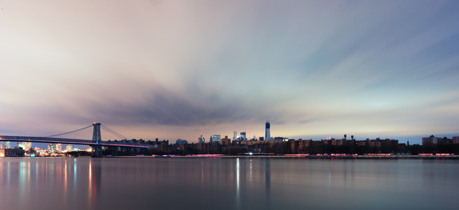
Can New York City Survive the Sea?
Can New York City Survive the Sea?
How did the largest city in the United States become the most prone to flooding?
While wandering New York City’s asphalt streets and peering up at its towers of steel and glass, or while driving the parkways and roads that crisscross the metropolitan area, it is easy to forget that, as little as a hundred years ago, the city was situated smack in the middle of tidal wetlands. By one account, some 300 square miles of wetland—an area about a quarter of the size of Rhode Island—covered the ground within a twenty-five-mile radius of City Hall in Lower Manhattan. It was easy to forget, that is, until Hurricane Sandy came roaring through in 2012 and the sea returned to its old haunt.
From a natural hazards perspective, the nation’s largest city is up against some bad numbers. Consider, for a moment, the risk of flooding in New York. Back in 1983, the Federal Emergency Management Agency (FEMA) mapped the flood risk of New York City and found that thirty-three square miles of the Big Apple fell within the hundred-year floodplain—that is, the area that has a 1 percent risk of a flood in any given year. The maps languished and were not updated even though FEMA was aware that it had understated the risk of flooding in the city. Then came Hurricane Sandy, and suddenly FEMA decided that it was time to revise the maps.
What it discovered was that the land area at risk of flood was 45 percent larger than what was reflected on the original maps. And worse, the new FEMA maps reveal that almost 400,000 New Yorkers are living on the hundred-year floodplain. More people in New York than in any other U.S. city, including New Orleans, are living with the prospect of high water encroaching on their lives.
Given the reality of global climate change, there is likely to be even more high water in New York’s future. A panel of climate experts convened by the city reported more grim news last year: its mid-range projection of sea level rise by the 2050s is eleven to twenty-four inches, though the figure could be as high as thirty-one inches. It’s true that these are projections and that the maps of the floodplain based on them may not be completely accurate. But this is the best data currently at our disposal. And if the highest estimate for sea level rise does indeed hold up, some 800,000 New Yorkers will find themselves living with the real possibility of being swamped.
This means that it is a good time to ask some important questions. How did the largest city in the United States wind up in this perilous situation? What has been done to address the prospect of climate change and its impact on flooding in the city? And finally, what is the likelihood of tackling these issues during what is being fashioned as a new political era in New York, under a mayor who speaks of a “tale of two cities”? Does Bill de Blasio have any real intention of intelligently confronting the environmental future of New York, much less addressing the stakes involved in climate change for the city’s poor and dispossessed?
New York has a long history of thumbing its nose at the sea. The Dutch colonists took some of the initial steps to wade out into the water—building a pier, for example—but it was the British who followed them who transformed underwater land into a commodity. This move formed the basis for the physical expansion of the island of Manhattan. Back in the 1600s, the lower part of the island ended at what is now Pearl Street, a couple of blocks inland from where it ends today. But grants to underwater land, made by the Crown and then the state of New York, expanded the city’s underwater real estate. By 2010 such expansion had added 2,286 acres—the equivalent of more than 1,700 football fields of land—to the island.
The process of encroaching on the sea, which began at the tip of Manhattan, was then replicated in other places around New York Harbor, including Brooklyn and Queens and, across the Hudson River, in Jersey City and Hoboken. Indeed, before massive landfilling operations in the 1800s, Hoboken was an island community, and Jersey City little more than a spit of land connected to the mainland at low tide by a soggy marsh.
As New York rose to become the nation’s largest city—a position it has retained for some 200 years—it continued to grow at the expense of its surrounding waters. The rise of the city’s red-hot real estate market in the latter part of the 1800s, meanwhile, helped to underwrite the idea of New York City as a limitless proposition. What historians Edwin Burrows and Mike Wallace have dubbed the “City of Capital” was premised on a particular relationship between land and sea, one founded on a growth imperative designed to produce more of New York’s scarcest commodity: land. The result was increased building on the floodplain and beyond on land wrested from the ocean itself.
By the twentieth century, those on the margins of the city experienced the brunt of the city’s quest to grow. Even as late as 1900, New York City was a swampy environment dominated by wetlands. Over the course of the century, however, in part under the leadership of that master builder Robert Moses, New York’s once magnificent stock of wetlands came under attack. Roads, parks, and landfills all started to bear down on the marshy grounds. At the Flushing Meadows in Queens, the 2,400 acres of marshland in existence in 1900 were completely wiped out by 1966. In New York Harbor as a whole, more than 17,000 acres of wetland estimated to exist in the mid-1800s vanished during the golden age of American capitalism (1953–73) to make way for roads, landfills, and the expansion of Kennedy Airport.
All this building on low-lying ground made the city increasingly vulnerable to flooding. And yet the quest to impinge on the sea continues to have its supporters. A plan currently afloat involves building a land bridge from Lower Manhattan to Governors Island. Masterminded by Columbia University’s Center for Urban Real Estate, the plan would involve millions of cubic yards of landfill and result in tens of millions of square feet of new development. The ecological implications of such a massive project remain little more than speculation at this point. If nothing else, the idea demonstrates that the quest to encroach on the ocean is alive and well in Gotham.
New York’s current flood risk was hardly etched in stone, even if the city was built on an archipelago. Nevertheless, the inescapable reality is that New York, when compared with other major port cities around the globe (those with over 1 million people in 2005), has a major coastal flooding problem on its hands. The city makes the top-ten list of port cities whose population and assets are most exposed to flooding. More disturbing still, its level of protection from coastal flooding is just a fraction of that of better protected cities such as London and Rotterdam. There is a simple reason why these European cities are better defended than New York. Both have built storm-surge barriers—the Thames Barrier in London and the Maeslant Barrier in Rotterdam—to ward off the sea.
Why hasn’t New York built a similar barrier to deal with the threat of flooding? It is not that the idea of barriers has not been considered. After Hurricane Donna in 1960 (which, until Hurricane Sandy, held the record for creating the highest water level measured at the Battery), there were plans afoot to build hurricane barriers at the entrance to Lower New York Bay, at Throgs Neck, and across Rockaway Inlet to protect the city from its surrounding waters.
A national study group, however, rejected the Rockaway Inlet barrier plan on the assumption that hurricanes rarely occur in New York. However, it’s crucial to note that the hurricane risk was high and growing as more and more people and assets piled into the city. Meanwhile, environmental groups raised concerns that the barrier would interfere with the flushing action of the tides, which would worsen Jamaica Bay’s already significant pollution problem, caused by all the effluent coursing into the water from sewage treatment plants. In the end, the larger plan for three massive barriers was never carried out because of the huge costs involved. Political leaders, even in American capitalism’s most vibrant, booming postwar phase, were unable to summon the political will and resources to fund the building of a barrier protection plan to help save the country’s largest city.
It’s important to understand that the potential for hurricanes in New York is in part a function of the larger climatic picture. The Atlantic Multidecadal Oscillation—a cyclical trend of warming and cooling of surface temperatures in the North Atlantic—is especially relevant. The warm phase increases the probability that weak storms might evolve into hurricanes; a warm phase from the 1930s through the 1950s produced a spate of storms, including the notorious 1938 hurricane that swept across eastern Long Island and Hurricane Donna in 1960. When temperatures cooled, New York entered a period of hurricane quiescence that lasted through the mid-1990s. The perils of environmental determinism—indeed of any determinism—are obvious. But it’s hard to deny that interest in building barriers to protect New York declined as the ocean cooled and hurricanes petered out on arrival in the city, as was the case in the 1980s and 1990s.
Political leaders, even in American capitalism’s most vibrant, booming postwar phase, were unable to summon the political will and resources to fund the building of a barrier protection plan to help save the country’s largest city.
Then the ocean warmed, and once again a barrier plan was put forward for protecting New York, this time by a group of scientists at Stony Brook University who proposed three (later four) barriers, modeled on similar structures in England and the Netherlands.
One would think that Hurricane Katrina in 2005 would have given New York’s political leaders pause and helped to bolster prospects for a barrier plan. Indeed, two years later, Mayor Michael Bloomberg released the most sweeping environmental plan in the city’s history and announced the creation of a panel of scientific experts to consider the threats posed by climate change to New York. The Bloomberg administration’s plan, dubbed PlaNYC: A Greener, Greater New York, specifically mentioned storm-surge barriers as one avenue for protecting the city from coastal flooding. But the plan also pointed out that no barrier could protect all New Yorkers and that such a course of action would also be costly.
There is no denying the expense and the bureaucratic stumbling blocks in the way of building a massive barrier project. Nor is it possible to go ahead with such a plan without closely examining the ecological impact of placing such large structures around the harbor. There is also concern from some quarters that taking a structural approach to the problem might only create a false sense of security, green-light more development in low-lying areas, and lead to even more destruction should a storm that breaches the barriers come along.
Nevertheless, Douglas Hill, an engineer affiliated with the Stony Brook Storm Surge Research Group, remains frustrated. He argues that New York has failed to fully absorb the lessons of Hurricane Katrina—which highlighted the perils of an ad hoc approach to flooding—and the necessity for cities to focus on public safety rather than simply on preserving infrastructure. He is also dispirited by the overall focus on hundred-year protection, which is too low a figure given all the people and wealth at stake, and by city leaders’ refusal to acknowledge that hurricane barriers have worked (at least so far) in large European cities and smaller U.S. ones such as Stamford, Connecticut, and Providence, Rhode Island. He depressingly concludes that “New York City plans to be flooded.”
One of the last things Bloomberg did while in office was oversee the release of a $19.5 billion plan to protect the city from storms. The plan did not recommend giant storm-surge barriers but opted instead for a pluralistic approach involving small barricades at the Gowanus Canal and Newtown Creek in Brooklyn, portable floodwalls for Red Hook and East Harlem, levees, and the regeneration of the old marshlands around the city to help reduce the impact of wave action. The plan amounts to an effort to surround New York with protection using a whole range of smaller projects instead of employing massive structures. If nothing else, the Bloomberg plan bucks the trend of large cities across the world employing vast engineering schemes to shut out the sea. It’s a kind of avant-garde approach to natural hazards that seems to overlook the fact that, whatever their faults, the great barriers have worked so far, while the Bloomberg game plan remains untested.
But whether New York opts for Bloomberg’s approach or a giant barrier scheme, the project will largely be carried out by the U.S. Army Corps of Engineers with federal tax dollars, something that presents its own problems. The obvious objections have been raised by the political right about spreading the costs to taxpayers across the country. But a less obvious concern involves the developer-friendly values that have long dominated the approach of the Corps of Engineers. This is, after all, the same organization that in the 1980s was called out by a federal appeals court for its “Orwellian-like ‘doublespeak’”—essentially lies—about the environmental implications of Westway, a sweeping landfill plan that would have encroached on land along the Hudson River on the west side of Manhattan. And it’s the same organization that responded to the 1965 flooding during Hurricane Betsy in New Orleans by paying more attention to the development potential of wetlands than to saving lives—in part helping to set the stage for the 2005 Hurricane Katrina disaster. It is not that the Corps of Engineers lacks engineering talent. Rather, the problem is that the agency is hamstrung by the cost-benefit calculus that informs its approach to flood protection projects. As the U.S. Government Accountability Office concluded in a 2003 report, the agency “is not required to formally estimate the number of lives saved or lost as a potential effect of a project.”
It is hard, then, to feel particularly bullish about Bill de Blasio’s ability to address coastal flooding, especially since he is hampered by the Bloomberg administration’s environmental legacy. One of Bloomberg’s signature achievements was to turn the growth imperative (“‘Growth is good,’ to echo Gordon Gekko’s ‘Greed is good,’” is how Daniel Doctoroff, a former deputy mayor, explained Bloomberg’s position on this matter) into a form of environmentalism. Bloomberg argued that growing New York addressed global warming because of the energy efficiencies bound up in dense city life—walking to work, taking the train, and living in apartments with shared walls.
There is significant truth to Bloomberg’s stance. Cities can indeed help to address global warming by promoting efficient energy use and lowering greenhouse gas emissions. But piling more people into a low-lying environment, while helping to address one problem, creates another. Under Bloomberg, nearly 40 percent of the city was rezoned—a colossal figure—to make way for population growth (the city is expecting to add 800,000 more people by 2030) and the redevelopment of waterfront areas with luxury housing. That leaves de Blasio to preside over a city that may address global warming but also has a vulnerable population in need of evacuation in the event of a storm—from a set of islands, no less. Moreover, de Blasio is left with having to address this vulnerability in a context that, whatever the virtues of Bloomberg’s storm protection plan, is still largely hostile to the idea of government playing a positive role in society.
Social reform is of course the centerpiece of de Blasio’s administration, at least so far. But he needs to remember that coming to grips with storms and flooding is part of that same agenda.
Whether de Blasio intends to move beyond Bloomberg’s market-driven approach to growth is an open question. But there is yet another problem facing New York as it moves forward during the de Blasio administration. For all its virtues—its progressive social and economic agenda, its embrace of grassroots organizing on behalf of the poor and low-wage workers—there is no evidence so far that de Blasio’s administration has any substantial interest in incorporating environmental reform into his political agenda. Save for a five-page statement on sustainability in which he briefly endorsed Bloomberg’s storm protection plan, de Blasio has so far not made environmental issues, much less storm protection, a central part of his political vision. His first major speech ignored the issue (though he did mention trying to help the victims still recovering from Hurricane Sandy).
Social reform is of course the centerpiece of de Blasio’s administration, at least so far. But he needs to remember that coming to grips with storms and flooding is part of that same agenda. Though the coast is being gentrified, it has long been home to New York’s most vulnerable, who live in public housing in the Rockaways, Red Hook, and Coney Island. Worse still, minority populations living in the floodplain tend to be undercounted and are therefore at a disadvantage when it comes to plans for emergency preparedness and relief.
In the battle between New York and its surrounding waters, the city has for quite some time appeared to hold the upper hand. But the world is changing. Now is the time for de Blasio to show some leadership not just in addressing the pressing social issues of our time, but the ecological ones as well. At a minimum, he needs to recognize that the arbitrary boundaries of the City of New York are not helpful for addressing the problem of coastal flooding. Instead, he needs to do something no New York City mayor has done before. He must transcend the boundaries of city and state and adopt a more ecological approach; he must recognize that a metropolis has grown up in the estuary of the Hudson River, a place consisting of an intricate, vast, interconnected tidal network. Otherwise, he risks seeing his sincere hopes for New York washed out to sea.
Ted Steinberg is Davee Professor of History and Professor of Law at Case Western Reserve University. His new book is Gotham Unbound: The Ecological History of Greater New York (Simon & Schuster).